

Quick answer
Cotopaxi National Park's hiking options span beginner loops around Limpiopungo Lake (3,800m, 1 hour) to the José Ribas Refuge trail (4,800m, 2-3 hours one-way) and technical summit climbs requiring glacier gear and guides. Day hikers can explore páramo trails and volcanic slopes without permits, while summit attempts demand acclimatization, mountaineering equipment, and certified guides due to crevasse fields above 5,000 meters.
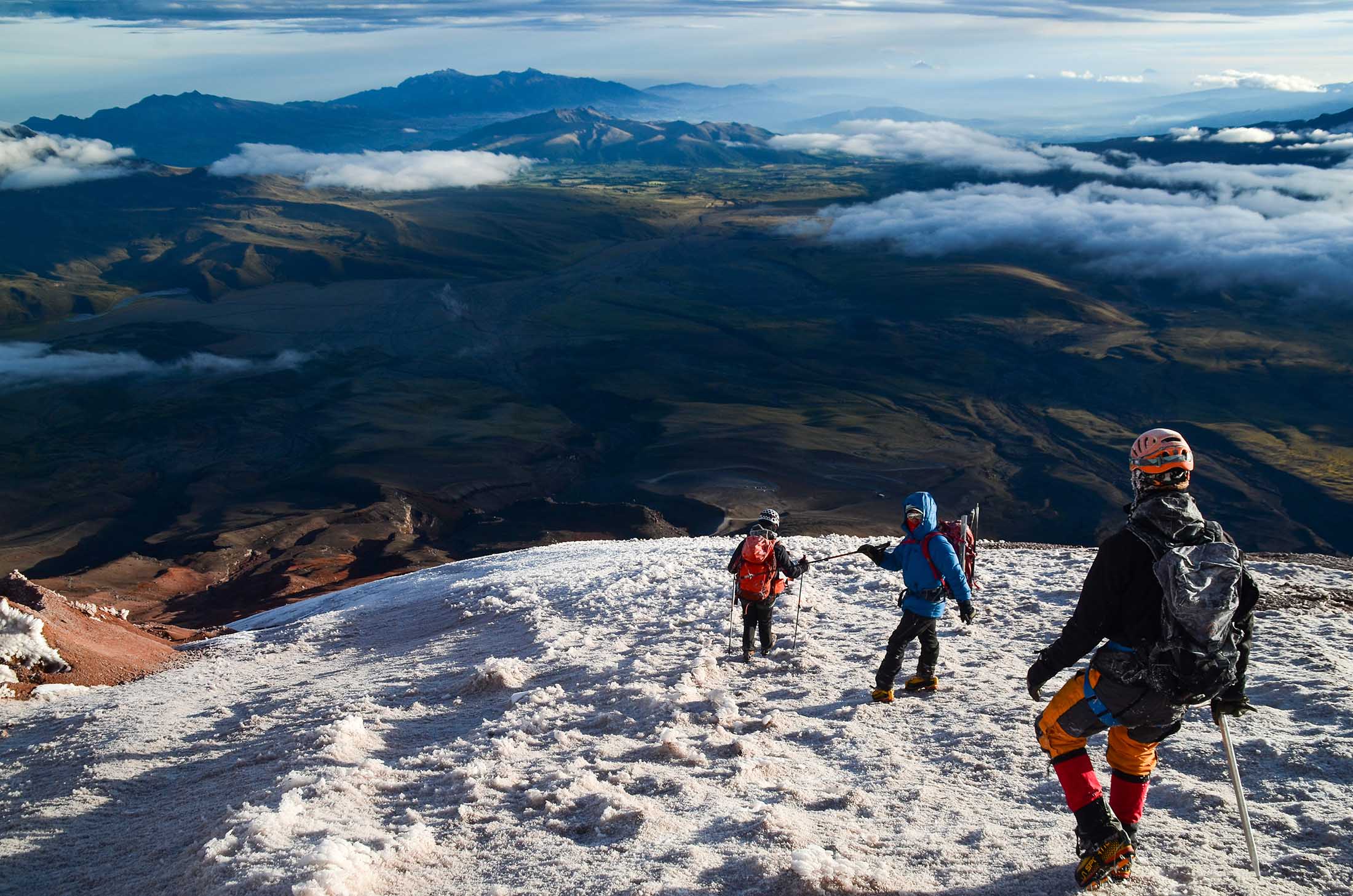
The volcanic cone rising from Ecuador's Avenue of Volcanoes hosts South America's most accessible high-altitude trail system. Cotopaxi's glacier begins at 5,000 meters, but the terrain below that threshold—páramo grasslands, ash slopes, and volcanic ridges—gives hikers a range of self-guided routes that require no technical skills. The Limpiopungo Lake circuit is the park's entry-level option. The trail traces the shoreline of a glacial lake at 3,800 meters, passing through tussock grass and offering unobstructed views of the stratovolcano's symmetrical profile. Andean gulls and occasional wild horses populate the wetland margins. The loop takes one hour at a walking pace and serves as a low-commitment acclimatization test for visitors arriving from sea level. The José Ribas Refuge sits at 4,800 meters on the volcano's north face and marks the staging point for summit attempts. The trail from the parking area at 4,500 meters climbs volcanic scree and sand for roughly two to three hours. No ropes or crampons are required to reach the refuge, but the altitude affects most hikers—headaches and shortness of breath are common above 4,600 meters. Climbers spend a night at the refuge before departing for the summit around midnight. Summit routes from the refuge navigate glacier fields, crevasses, and steep ice slopes, conditions that demand crampons, ice axes, and rope teams. Ecuadorian law requires certified mountain guides for all glacier travel. Most summit attempts take six to eight hours from the refuge to the crater rim and return before afternoon weather deteriorates. Success rates hover around sixty percent, with altitude sickness and wind forcing many parties to turn back. The park's road network provides parking access to trailheads, though vehicle clearance matters—the final stretch to the refuge parking requires four-wheel drive. Trails lack signage in English, and the park's open terrain makes route-finding straightforward in clear conditions but disorienting when fog descends.
“The glacier begins at 5,000 meters, but the terrain below that threshold gives hikers a range of self-guided routes that require no technical skills.”
Recommended Cotopaxi National Park Hikes and Visit Planning
This itinerary suits hikers comfortable with high altitude and basic mountain trails, covering approximately 6–8 hours including acclimatization stops and driving between zones. The route combines an accessible lakeside loop with a challenging refuge ascent, both starting from the main park access road.
Enter park and drive to Limpiopungo
Register at the gate with your passport or ID, then drive 20 minutes south along the park road to the Limpiopungo parking area at 3,800 meters. Allow 30 minutes for acclimatization before starting any hike.
Limpiopungo Lagoon loop
Walk the flat 4-kilometer trail circling the lagoon, observing Andean gulls, wild horses, and cushion plants against the backdrop of Cotopaxi's cone. The loop takes 60–90 minutes at a relaxed pace suited to altitude adjustment.
Drive to Parking Lot José Rivas
Continue 8 kilometers up the winding park road to the parking area at 4,500 meters, the trailhead for the refuge hike. Eat a snack and hydrate before beginning the ascent.
Hike to José Rivas Refuge
Climb the sandy, zigzagging trail 1 kilometer uphill to the refuge at 4,864 meters, gaining 364 vertical meters over 45–75 minutes. The trail is steep, loose underfoot, and exposed; pace yourself and turn back if altitude symptoms appear.
Rest at the refuge and descend
Spend 15–20 minutes inside the refuge to warm up and photograph the glaciers above, then descend the same trail in 30–40 minutes. The descent is faster but requires careful footing on the scree.
Return drive and park exit
Drive back down to the park entrance, allowing time to stop at viewpoints if clouds have not yet rolled in. Exit before the 15:00 closure to avoid being locked inside the park overnight.
Opening Hours for Cotopaxi National Park Hikes
Cotopaxi National Park maintains consistent operational hours throughout the week to accommodate visitors interested in hiking and climbing trails.
| Monday | 08:00–15:00 | |
|---|---|---|
| Tuesday | 08:00–15:00 | |
| Wednesday | 08:00–15:00 | |
| Thursday | 08:00–15:00 | |
| Friday | 08:00–15:00 | |
| Saturday | 08:00–15:00 | |
| Sunday | 08:00–15:00 |
Entrance Fees for Cotopaxi National Park Hikes
Access to Cotopaxi National Park does not require an admission fee. All visitors must complete a mandatory registration process at the park entrance.
The entry fee is 0 USD, provided you present a valid passport or official ID for mandatory registration.
Getting to Cotopaxi National Park Hikes
Cotopaxi National Park is located near Latacunga, Ecuador, and is most accessible via the Pan-American Highway (E35). Visitors typically reach the park entrance by private vehicle or organized transport from Quito.
E35 highway to the North Entrance near Machachi
Panamericana bus from Quitumbe terminal to the park turnoff
Direct hire from Quito city center to the park parking areas
Checklist for Cotopaxi National Park Hikes
Prepare for high-altitude hiking with the right gear and documentation.
-
Bring passport or national ID — Required for mandatory registration at the park gate.
-
Pack warm layers and waterproof jacket — Temperature drops sharply above 3,800m and weather changes quickly.
-
Wear broken-in hiking boots with ankle support — Rocky and volcanic terrain demands stable footwear.
-
Carry sunscreen and sunglasses — Intense UV exposure at altitude, even on cloudy days.
-
Take altitude sickness medication if sensitive — Park trails start at 3,800m; acclimatize in Quito first if possible.
-
Bring sufficient water and snacks — Limited facilities inside the park; stay hydrated at elevation.
-
Download offline maps — Cell signal is unreliable in remote trail areas.
Check availability
Frequently asked questions about cotopaxi national park hikes
Everything you need to know about cotopaxi national park hikes