
Quick answer
Cotopaxi volcano is located in Cotopaxi Province, Ecuador, approximately 50 kilometers south of Quito and 33 kilometers northeast of the city of Latacunga. The summit stands at 5,897 meters above sea level within Cotopaxi National Park, which is accessible from the Pan-American Highway via a clearly marked entrance near the village of Lasso. The park gate requires registration with a valid passport or ID, and entry is free.
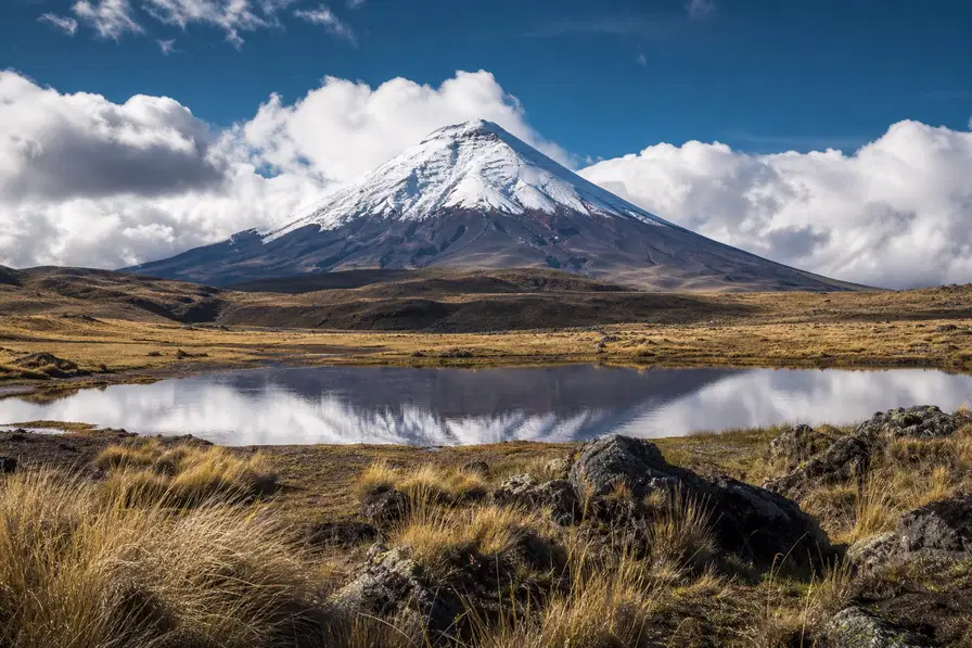
Cotopaxi occupies a commanding position in the central Andes, its near-perfect cone visible from Quito on clear mornings and from the agricultural valleys that stretch south toward Latacunga. The volcano sits within Cotopaxi National Park, a 33,393-hectare protected area established in 1975 to safeguard the paramo ecosystem and the glaciated peak itself. The park straddles two provinces—Cotopaxi and Pichincha—with the volcano's summit falling just inside Cotopaxi Province. Where is Cotopaxi volcano located relative to Ecuador's population centers? The answer matters for logistics. Quito, the capital, lies roughly one hour north by car via the Pan-American Highway. Most visitors approach from this direction, exiting the highway near Lasso and following a paved access road that climbs steadily through páramo grassland toward the park's northern entrance. The second approach originates in Latacunga, a smaller city 33 kilometers to the southwest that serves as a base for climbers and multi-day treks. Both routes converge at the park gate, where rangers record arrival times and verify identification. The volcano's geographic coordinates—0.6850° S, 78.4365° W—place it almost directly on the equator, a fact that shapes its weather. Mornings typically offer the clearest views of the summit; by late morning, orographic clouds driven by equatorial heating obscure the upper slopes. This pattern repeats daily and explains why the park recommends arrival between 08:00 and 11:00. The elevation gain from the gate at 3,800 meters to the José Ribas Refuge at 4,800 meters is steep, and acclimatization matters even for visitors who do not intend to summit. Cotopaxi's location within the Avenue of the Volcanoes—a term coined by Alexander von Humboldt in 1802—means it shares the skyline with Antisana, Illiniza, and Chimborazo. The stratovolcano last erupted in 2015, and fumarolic activity continues near the summit crater. The park remains open, but rangers monitor seismic data and can close access to the refuge with little notice. Understanding where Cotopaxi volcano is located includes understanding its status as an active geological feature, not merely a landmark.
“The volcano sits within Cotopaxi National Park, a 33,393-hectare protected area established in 1975 to safeguard the paramo ecosystem and the glaciated peak itself.”
Geographic Context: Where Is Cotopaxi Volcano Located?
Cotopaxi Volcano is situated within Cotopaxi National Park, located in the Andes Mountains of Ecuador, approximately 50 kilometers south of Quito. The most direct approach for visitors traveling from the capital is via the Pan-American Highway (E35).
Pan-American Highway (E35) South to the 'El Control' entrance
Bus from Quitumbe Terminal (Quito) to 'El Control' stop
Private hire from Quito city center to the park entrance
When to Visit for the Best Views of Where Cotopaxi Volcano Is Located
The best arrival window is 08:00–11:00. Arriving during this time allows you to view the summit before late-morning fog and afternoon clouds obscure the cone.
Dry Season (June–August)
Moderate to highCool, dry; 5°C to 15°C
Clearer skies increase visibility of the volcano. Plan your arrival early to avoid afternoon cloud cover.
Shoulder Months (April, May, October, November)
Low to moderateVariable; 4°C to 14°C
Frequent rain showers occur, but mornings often remain clear. Use the early arrival window to maximize photo opportunities.
Weekday mornings
Low—
Mid-week visits offer fewer visitors on the trails. Prioritize an early start to experience the park before peak daily attendance.
Verdict: The best time to visit is during the dry season months of June through August, arriving between 08:00 and 11:00 to ensure clear visibility of the volcano.
Weekly Operational Schedule: Where Is Cotopaxi Volcano Located Access Hours
Cotopaxi National Park maintains consistent daily operational hours for visitors throughout the week.
| monday | 08:00–15:00 | |
|---|---|---|
| tuesday | 08:00–15:00 | |
| wednesday | 08:00–15:00 | |
| thursday | 08:00–15:00 | |
| friday | 08:00–15:00 | |
| saturday | 08:00–15:00 | |
| sunday | 08:00–15:00 |
Preparation Checklist for Where Cotopaxi Volcano Is Located
Visiting Cotopaxi requires valid identification for park registration and preparation for high-altitude conditions at 4,800 meters.
-
Bring valid passport or national ID — Registration at the park gate is mandatory and requires government-issued identification.
-
Pack warm layers and windproof jacket — Temperatures at the parking area (4,600 m) and Refugio José Ribas (4,800 m) drop well below freezing.
-
Wear sturdy hiking boots with ankle support — Trails to the refuge cross loose volcanic scoria and steep terrain.
-
Carry water and high-energy snacks — Altitude sickness risk increases above 4,000 meters; hydration and fuel are essential.
-
Apply high-SPF sunscreen and lip balm — UV exposure intensifies significantly at elevation, even on overcast days.
-
Download offline maps before departure — Cell service is unreliable inside the park boundaries.
Check availability
Frequently asked questions about where is cotopaxi volcano located
Everything you need to know about where is cotopaxi volcano located